Tejano History
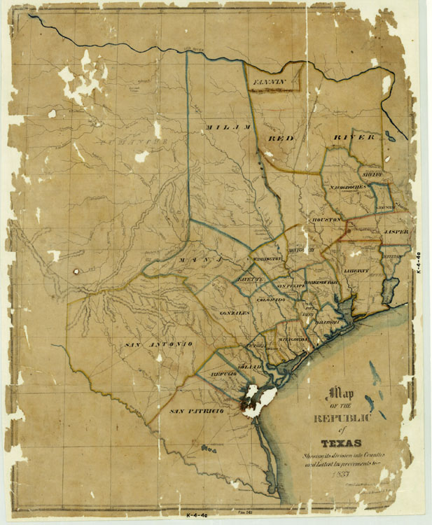
1837 Republic of Texas
Map/Doc #: 476
Digital TIF Size: 350.78 MB
Digital PDF Size: 6.21 MB
Subject: Republic Maps.
Title 1: Map of the Republic of Texas Showing its division into Counties and Latest Improvements too
Region: Texas
Creation Date: xx/xx/1837
Compiler: H. Groves
Draftsman: H. Groves
Size: (in inches) 30.9 x 23.6
Format: lithograph
General Features: roads
Named Features: Counties (early districts), Rivers, Creeks
Collection: State
Comments: Originally published to accompany a publication titled “City of Galveston Island, in Texas”.
Has a history of the title of the proprietor and a brief account of all its advantages.
Accompanied with a plan of the city and harbor and a map of Texas, showing the commerical channels with the interior through which the city is to derive its extensive trade.”
Conserved in 2001 with donation from Bob and Su Duggan.
Maps courtesy of Texas General Land Office
Join
Us