Tejano History
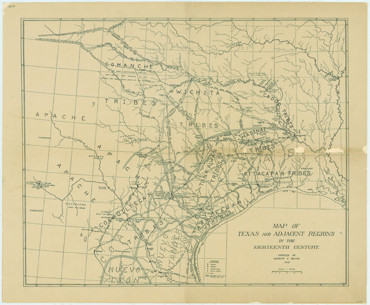
1700s Map of Texas and Adjacent Regions
Map/Doc #: 79743
Digital TIF Size: 53.94 MB
Digital PDF Size: 4.49 MB
Subject: Pre-Republican Maps.
Title 1: Map of Texas and Adjacent Regions in the Eighteenth Century
Creation Date: xx/xx/1915
Compiler: Herbert E. Bolton
Size:(in inches) 16.9 x 20.5
Format: digital image
Scale Per Inch: 37 miles
Collection: State
Comments: TSLAC Map 1440. More information is here
Prints available from the GLO courtesy of the Texas State Library and Archives.
Courtesy of the Texas State Library and Archives Commission and the Texas General Land Office.
Join
Us