Tejano History
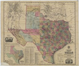
1874 Map of State of Texas Rivers
Map/Doc #: 76254
Digital TIF Size: 223.49 MB
Digital PDF Size: 94.27 MB
Subject: State Maps.
Title 1: A. R. Roessler's Latest Map of the State of Texas Exhibiting Mineral and Agricultural Districts, Post Offices and Mailroutes, Railroads projected and finished, Timber, Prairie, Swamp Lands, etc. etc. etc.
Creation Date: xx/xx/1874
Publisher: A. R. Roessler
Compiler: M. V. Mittendorfer
Draftsman: M. V. Mittendorfer
Size: (in inches) 39.7 x 46.8
Format: digital image
Scale Per Inch: 20 miles
Collection: State
Comments: TSLAC Map 1687. More information is here
Prints available from the GLO courtesy of the Texas State Library and Archives.
Maps courtesy of Texas General Land Office


